

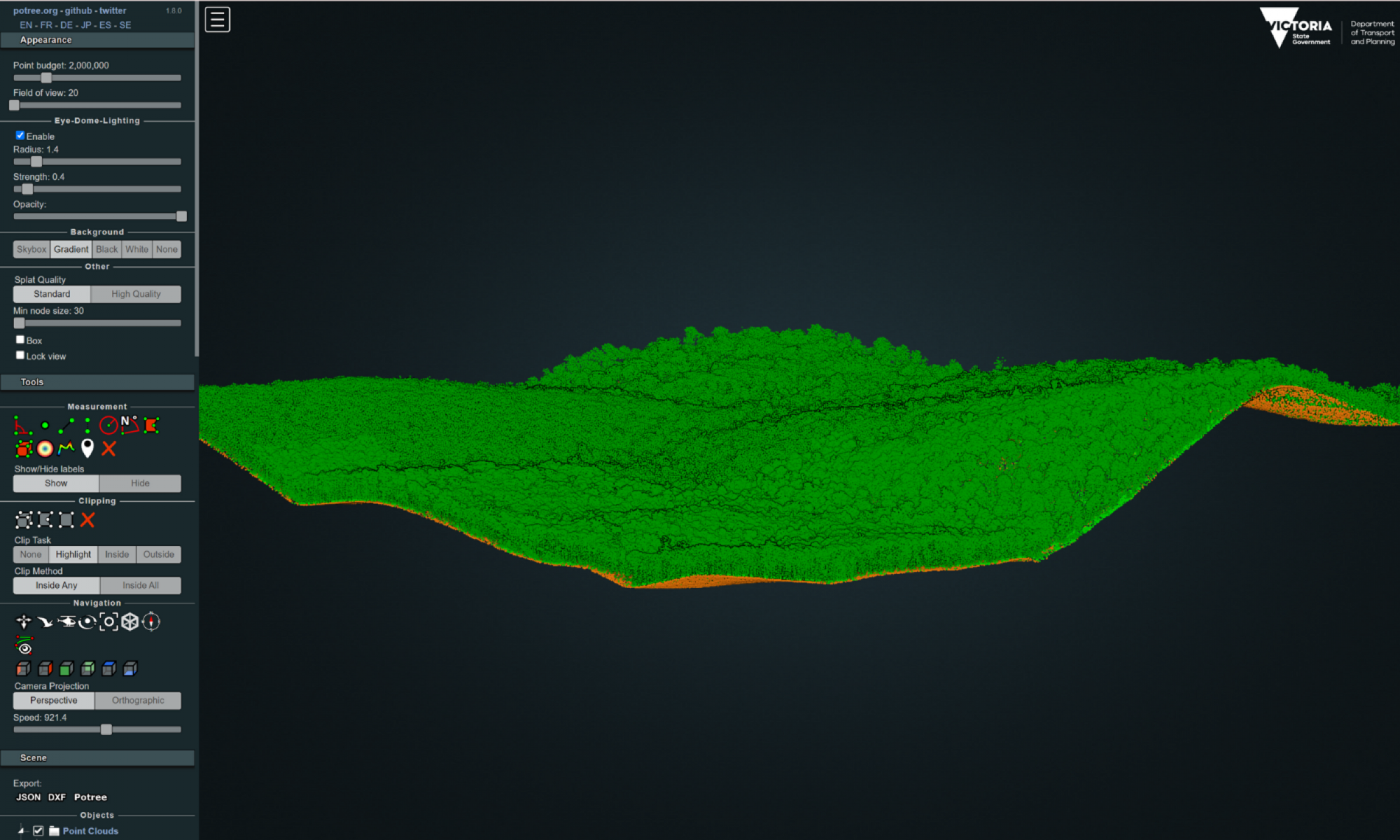
- Point-cloud profile view of a forest in East Gippsland.
- View of elevation products (DEM/CHM) using hillshade and false-colour for height above ground.

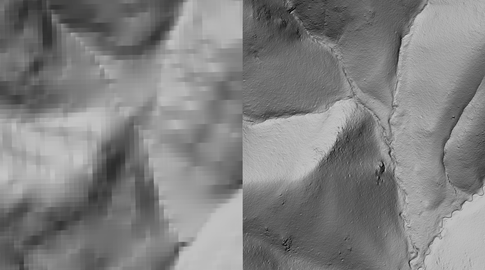
- Comparison between existing 10 m resolution DEM (left) and new 50 cm DEM (right).
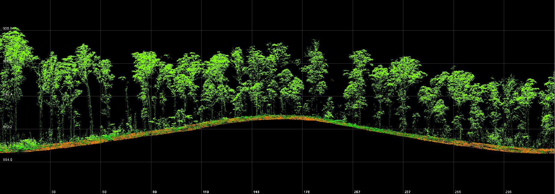
Point-cloud profile view of a forest in East Gippsland.

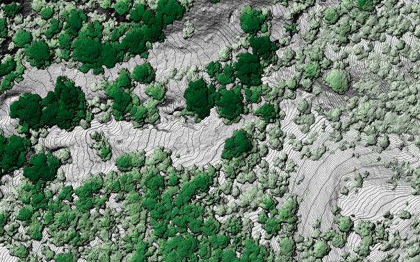
View of elevation products (DEM/CHM) using hillshade and false-colour for height above ground.
Comparison between existing 10 m resolution DEM (left) and new 50 cm DEM (right).
Regional Forest Agreements (RFAs) are 20-year agreements between the Australian and state governments for the conservation and sustainable management of Australia's native forests. The 2020-21 RFA LiDAR project represents the state's largest-ever acquisition of LiDAR for the purposes of mapping forest values. This data has been used to create high-resolution 3D models of Victoria’s forest structure - from the top of the forest canopy through to the understorey.
Through collaboration with the University of Melbourne and Monash University, researchers modelled detailed and accurate forest maps. These maps can be used to improve fuel load modelling for fire management purposes and to understand the interaction of critical species and their forest environments.
Extent: 13,419 km2
Point density: 22 points/m2 (first returns)
Colourised: No
Coordinate reference system: GDA2020 MGA 55, AHD
Point cloud: LAZ 1.4, ICSM level 2
Elevation products and resolution: DEM 50 cm, CHM 50 cm, FCM 10 m, INT 1 m
Vertical accuracy: 10 cm (RMSE)
Availability: Open via Geoscience Australia ELVIS
Partner agencies: Department of Environment, Energy and Climate Action (DEECA).
Page last updated: 12/10/23