
3 November 2023
Our state border is more than just a line on a map - it defines the legislative boundary for Victoria. It also serves as the cornerstone for governance, state relations and resource management. Yet over time, changing environmental and technological factors have proven a challenge in maintaining the accuracy of its spatial representation.
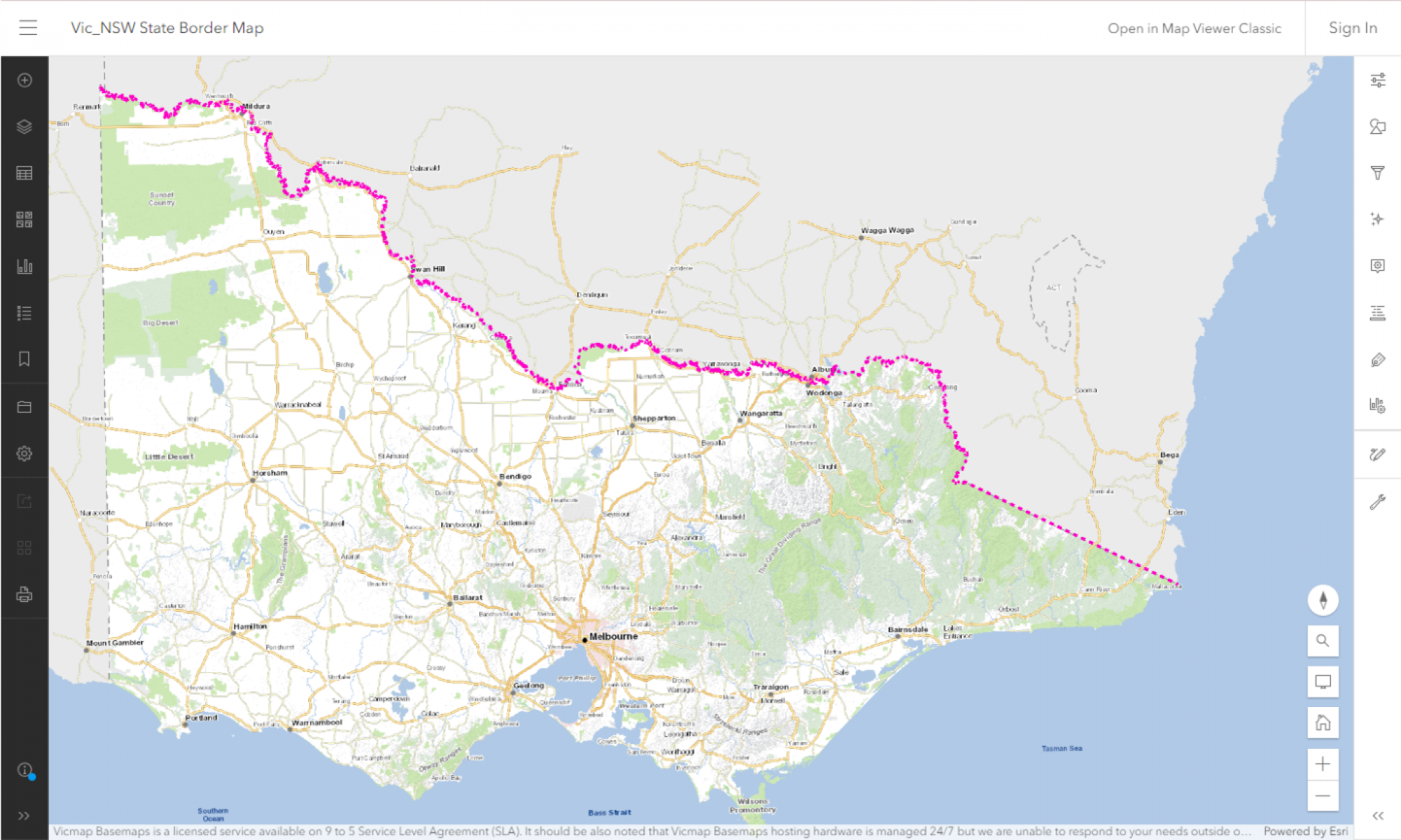
To address these challenges and leverage modern technology, efforts to improve the spatial representation of the Victoria and New South Wales (NSW) border have been underway by Surveyor-General Victoria (SGV) since 2012. The work is also part of an Intergovernmental Committee on Surveying and Mapping (ICSM) initiative to recapture coastlines, land borders and territorial sea baselines.
In collaboration with Surveyor-General NSW, SGV has completed the digital capture of the single-line representation of the border. Surveyors-General reached jurisdictional agreement in June 2021. This endeavour was no small feat given that the border is described by no less than 6 different pieces of legislation.
The course of the Murray River in 1851 was used as part of the original boundary. However, since the separation of the states in 1851, the course of the Murray River has changed significantly.
The project used modern technologies including Global Navigation Satellite System (GNSS) surveying, LiDAR and high-resolution aerial imaging. These technologies have revolutionised border mapping. They greatly assist where traditional survey methods are challenging due to the terrain. Advanced technologies are also more efficient to use, and enable a more accurate representation of state border lines.
The improved spatial representation of the Victoria-New South Wales border is due to be integrated into Vicmap later this year. Enhancements to the border will also contribute to the Vicmap Spatial Upgrade. The upgrade is delivering improvements to Vicmap’s position accuracy.
A preview of the single-line spatial representation of the border is now available for viewing. To keep up-to-date on Vicmap news and hear the latest on the updated border, subscribe to Vicmap change notices.
Page last updated: 14/12/23