
15 November 2023
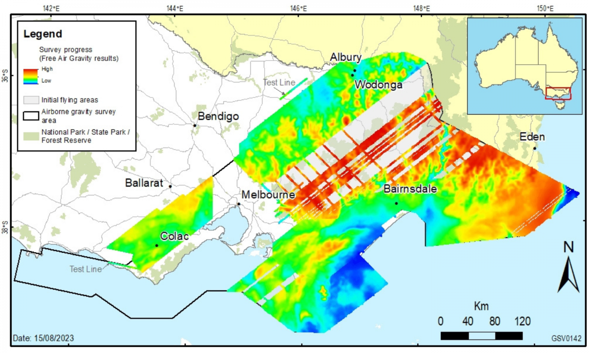
The airborne gravity survey has passed the halfway milestone, with 56.4 per cent of the survey area now complete over land and water in the Gippsland, Otway and Hume regions.
This large survey is being flown across southern and eastern Victoria to collect consistent and evenly distributed gravity measurements. This data will support global positioning system (GPS) technology advancements and improve the accuracy of heights from GPS positioning.
Following a pause to support the New South Wales completion of survey operations through the winter months, data capture in Victoria is scheduled to recommence in December over the Hume and Gippsland regions.
Experienced pilots, operating a DHC-6 Twin Otter fixed-wing aircraft, will fly along a planned route with flight lines spaced 500 metres to 1 kilometre apart. The aircraft will fly in public airspace at a nominated minimum ground clearance of 150 metres, increasing to 300 metres over built-up areas.
The specialised gravity sensing equipment does not emit any signals or impact people, animals or infrastructure in any way.
The new gravity data will significantly improve Victoria’s gravity model which is used to provide accurate and reliable heights for GPS positioning. The new data will also advance understanding of Victoria’s geological architecture and earth resource potential.
To support stakeholders, Geological Survey of Victoria recently released preliminary grids of the project’s initial acquisition stages across the Otway, Hume and Gippsland regions. When the project is complete, all processed gravity data and model products will be made available through Geoscience Australia and the Victorian Government’s online data portals.
The airborne gravity survey will continue throughout 2024 and stakeholders will be notified a minimum of two weeks before operations start in each region.
This project is being collaboratively organised by Surveyor-General Victoria, Geological Survey of Victoria and Geoscience Australia.
Read more about our airborne gravity survey:
Page last updated: 16/11/23