
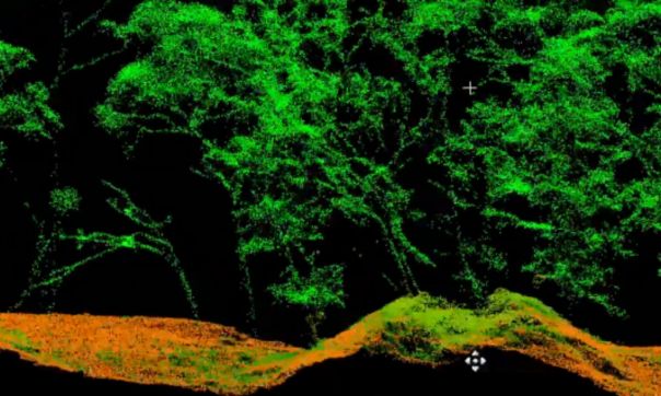
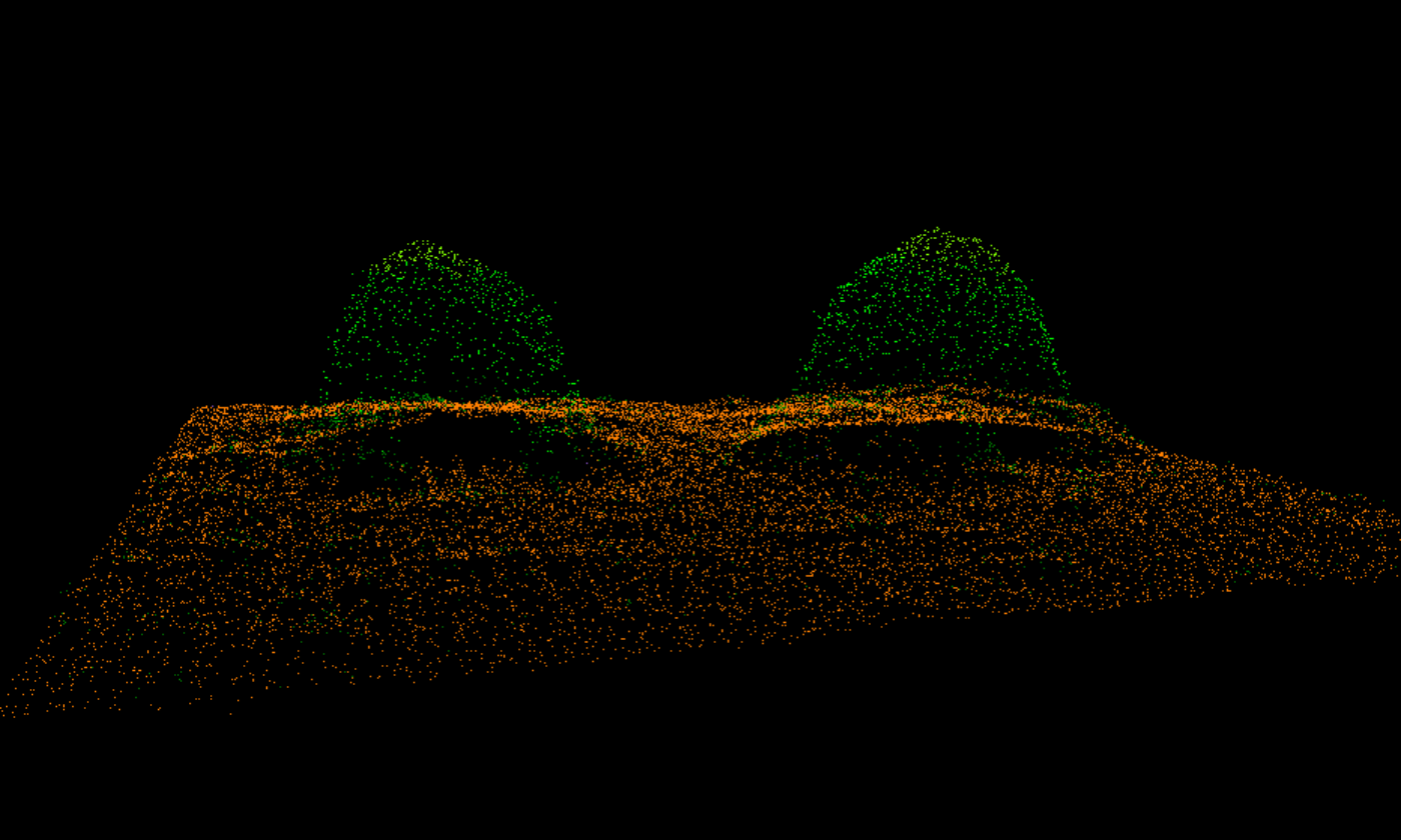
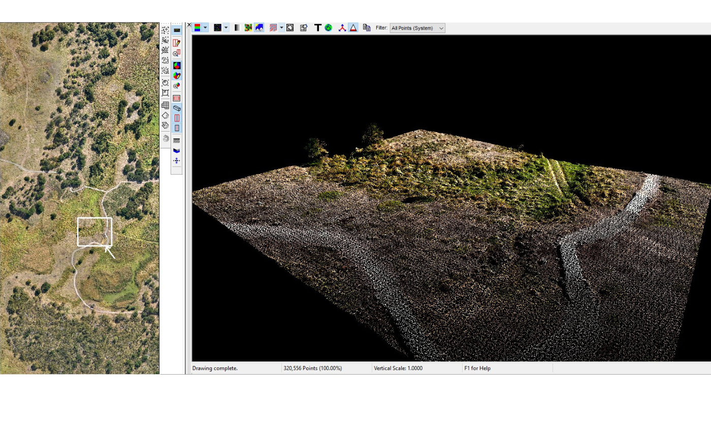
- High-density LiDAR penetration through forest canopy reveals ground surface details.
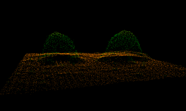
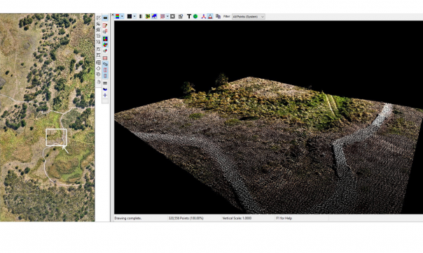
- LiDAR point cloud over demonstration huts at visitor centre.

- Known hut site showing stone remnants.

- Known hut site remnants visible in high-resolution DEM.

- Detailed ground surface representation available under dense woodland.
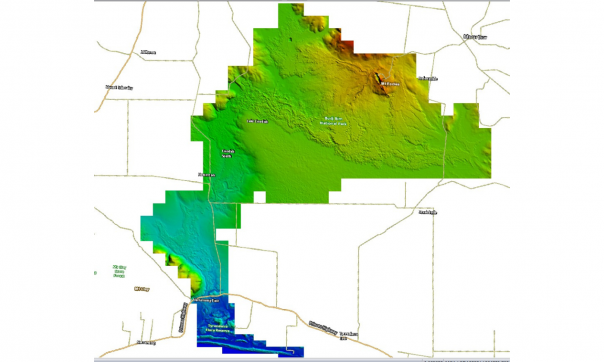
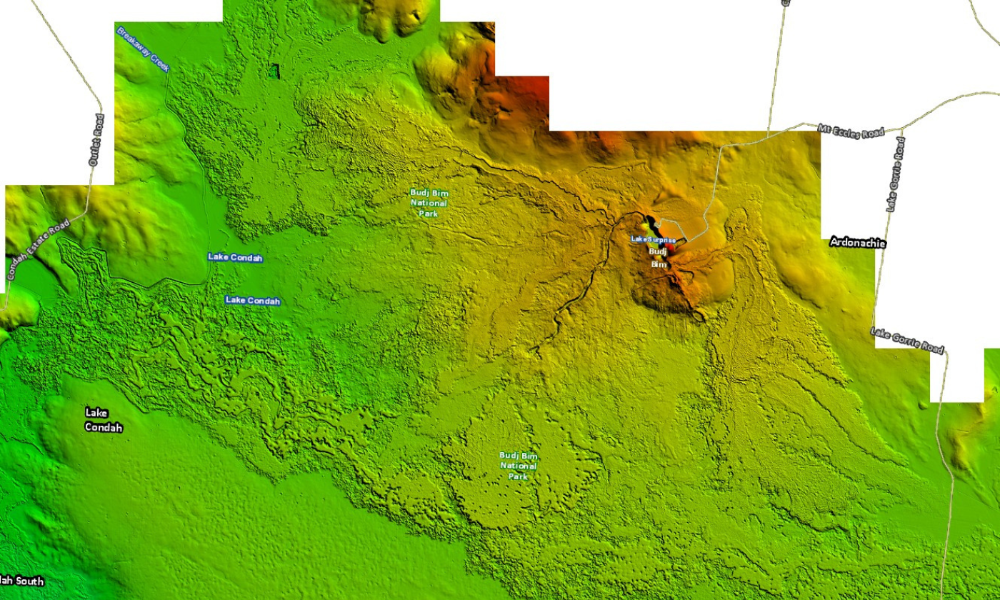
- Entire Budj Bim LiDAR project survey area.
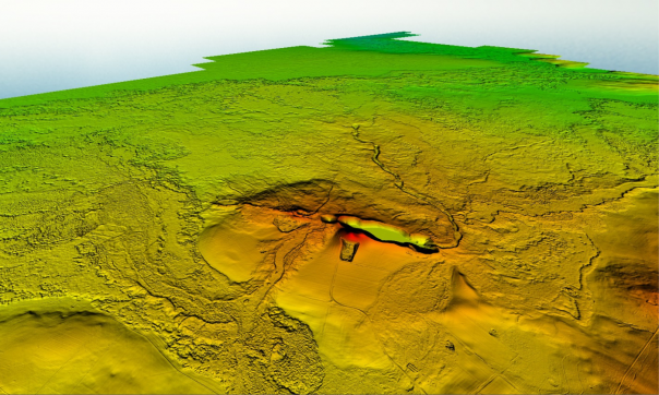
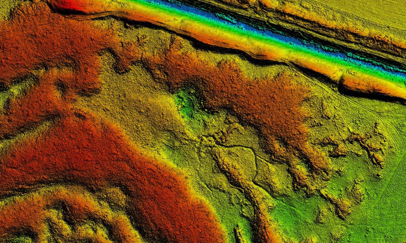
- Lava flows evident from Mt Eccles.

- Budj Bim lava landscape.
- Known eel trap site near visitors centre.

High-density LiDAR penetration through forest canopy reveals ground surface details.
LiDAR point cloud over demonstration huts at visitor centre.
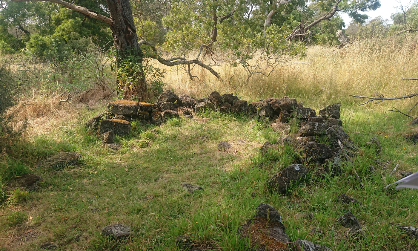
Known hut site showing stone remnants.
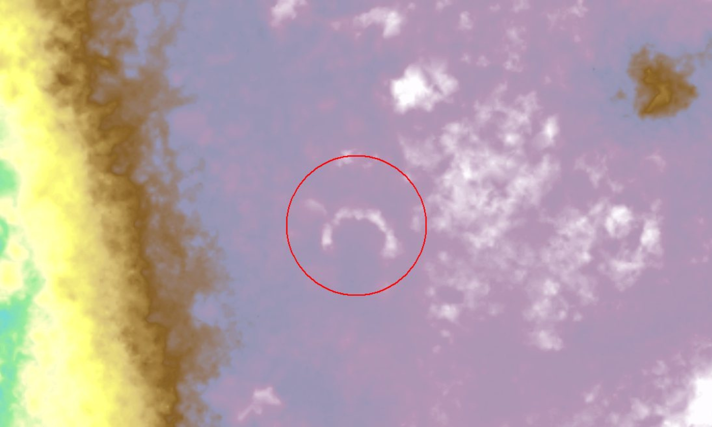
Known hut site remnants visible in high-resolution DEM.
Detailed ground surface representation available under dense woodland.

Entire Budj Bim LiDAR project survey area.

Lava flows evident from Mt Eccles.
Budj Bim lava landscape.
Known eel trap site near visitors centre.
In 2019-20, the State partnered with the Gunditj Mirring Traditional Owners Aboriginal Corporation (GMTOAC) to provide high-resolution mapping, including high-density LiDAR, of the UNESCO World Heritage-listed Budj Bim region in south-western Victoria.
Budj Bim contains one of the world's oldest and most extensive aquaculture systems. The data was used by the Traditional Owners to discover undocumented areas of fish traps and remnant stone huts and will continue to be used for many land management purposes to protect this important Aboriginal Heritage site. The GMTOAC owns this data and any use requires their permission.
Extent: 300 km2
Point density: 30 points/m2 (first returns)
Colourised: RGB
Coordinate reference system: GDA2020 MGA 54, AHD
Point cloud: LAS 1.4, ICSM level 2
Elevation products and resolution: DEM 10 cm, DSM 10 cm, INT 10 cm
Vertical accuracy: 10 cm (RMSE)
Availability: Restricted via coordinated.imagery@transport.vic.gov.au
Partner agencies: Gunditj Mirring Traditional Owners Aboriginal Corporation.
Page last updated: 17/09/24